Saturday, March 11, 2006

Whoo hoo!


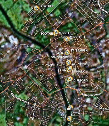
Using LoadMyTracks I managed to get my ley line points of York, UK with a map underlay using GoogleEarth... fab! I feel like I've taken a first step of sorts.

Now, can I identify a section of map and upload it onto my Garmin? And would I want to?

Any ideas?

GeoRSS

A while ago, I blogged about how easy it would be to put location data (and essential time data) inside an RSS file, and I was pointed towards sites that let you "add events"... not what I had in mind at all. But I just stumbled over GeoRSS... which seems straight forward enough.

I see that a Guardian reporter has raised the issue of how we (in the UK) pay for a shed load of data to be collected, then pay again as our councils licences that data back from Ordance Survey. Ed Parsons refutes this, but then, regardless of the facts, he would wouldn't he (working for OS). Not knowing enough about the politics of GIS data one thing is very, very clear... that for some reason there are lots of free maps available to people in the US and none for the UK. Not even an average street map, which I find "wrong" somehow.

Open Street Map

So, having used LoadMyTracks to create a .gpx file to add to OpenStreetMap... but I seem to be able to only see a visualisation or the xml generated...mmph!

I found this Open Source GIS page which is about as useful as they (don't) come. Firstly, in information design terms, any list with more than 20 items on it is not a list, it is a waste of time, secondly, any list organized alphabetically is almost random (who ever thinks the thing I haven't heard of yet probably starts with "P" or maybe "S"...)

I need a GIS guru with a lot of patience to ask my dumb questions of...

Load My Trackes

I tried LoadMyTracks today.

Not quite sure what I doing, it spat out a file and I thought, "so what?"... then realized I had to load it into googleearth... but when I did that it crashed...

So near and yet not...