Saturday, March 11, 2006

Whoo hoo!


Using LoadMyTracks I managed to get my ley line points of York, UK with a map underlay using GoogleEarth... fab! I feel like I've taken a first step of sorts.

Now, can I identify a section of map and upload it onto my Garmin? And would I want to?

Any ideas?

GeoRSS

A while ago, I blogged about how easy it would be to put location data (and essential time data) inside an RSS file, and I was pointed towards sites that let you "add events"... not what I had in mind at all. But I just stumbled over GeoRSS... which seems straight forward enough.

I see that a Guardian reporter has raised the issue of how we (in the UK) pay for a shed load of data to be collected, then pay again as our councils licences that data back from Ordance Survey. Ed Parsons refutes this, but then, regardless of the facts, he would wouldn't he (working for OS). Not knowing enough about the politics of GIS data one thing is very, very clear... that for some reason there are lots of free maps available to people in the US and none for the UK. Not even an average street map, which I find "wrong" somehow.

Open Street Map

So, having used LoadMyTracks to create a .gpx file to add to OpenStreetMap... but I seem to be able to only see a visualisation or the xml generated...mmph!

I found this Open Source GIS page which is about as useful as they (don't) come. Firstly, in information design terms, any list with more than 20 items on it is not a list, it is a waste of time, secondly, any list organized alphabetically is almost random (who ever thinks the thing I haven't heard of yet probably starts with "P" or maybe "S"...)

I need a GIS guru with a lot of patience to ask my dumb questions of...

Load My Trackes

I tried LoadMyTracks today.

Not quite sure what I doing, it spat out a file and I thought, "so what?"... then realized I had to load it into googleearth... but when I did that it crashed...

So near and yet not...

Monday, February 27, 2006

GPS on MacOS X

What I don't really get is... I can buy a Fugawi map... but sometimes it says it requires certain software... is a map data or software... I don't get it (see!).

I'd like an OS-like map (with contours, churches and pubs on) and a street map map... If I buy them, what do I do with them?

Ergonomic Usability?


It seems a Garmin is designed to be used with your left hand because if you use it with your right, your thumb obscures the screen.

York Leyline


Went out for a walk into York this Sunday so tried to input WayPoints for the York Ley Line including Clifford's Tower, St Mary's, All Saints and the Minster. The granularity seems quite good (or is it just inaccuracy I don't know) because as I walked around the Minster, the route appeared sort of outlining the building. That seems brilliant to me.

Now, how do I get a decent map both in MacGPSPro to underlay this... or on the Garmin... I have no idea. Do I need a Fugawi map or are there any free alternatives... Help anyone...

Sunday, February 26, 2006

Argh


Then I get this... ever feel like you are in too deep... I don't know what any of this means...

Running up MacGPS Pro

Having found the unusual USB lead that came with my Garmin (they cost a lot apparently) I went to the MacGPSPro site and paid. I plugged everything in and got this... oh bloody hell... what's this all about?

I'm assuming that because I'm inside the Garmin was looking for satellites so didn't get round to noticing it was being "talked to" by MacGPS pro.

The second time I ran it 'Garmin' was in the left hand side of this dialog... phew!

Getting Started Again: MacGPSPro


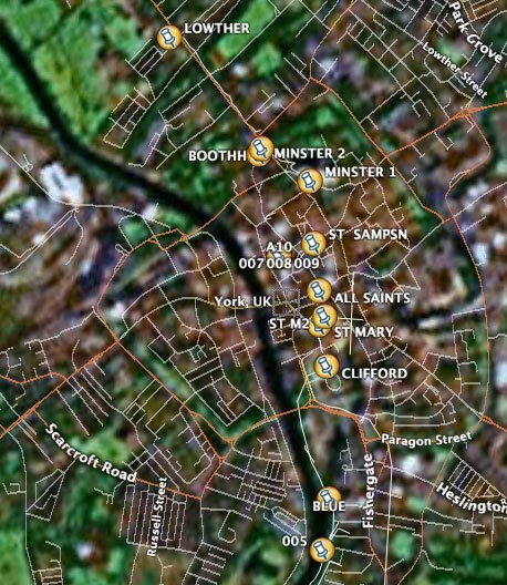
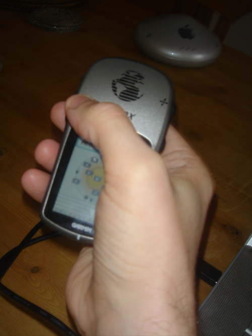
So, life has been busy so not had much chance to play with my Garmin Etrex Vista and the batteries went flat too. Excuses, excuses. I thought that...

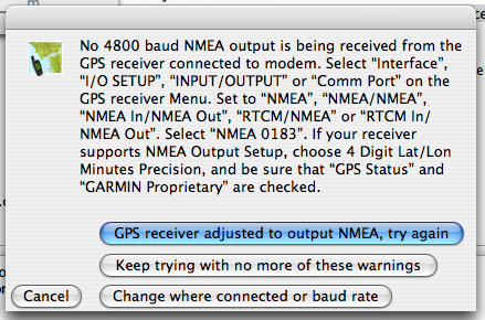
I'd be able to simple install X11 on my mac and have access to a heap of free tools, but since I last did this it seems that X11 is not free and easy to install. You can choose one, free or easy. I went down the "I want to do it myself" route using OroborOSX-v0.9 and got into a bit of a pickle. One of those pickles where you think you've got it running but you aren't too sure. Niggly errors niggle...

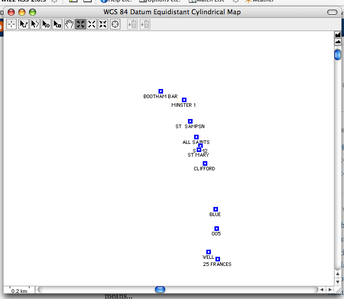
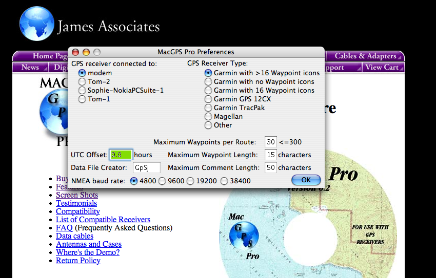
The world of GPS seems so confusing, I've now gone down the "easy" route, I hope by buying MacGPSPro. The install was nice.. innovatively they use an alias of your Applications folder... promising...

Saturday, January 14, 2006

Before I start

So I had a look at the GeoMax page and noticed that a lot of the free stuff seems to require X11. X11 is a windowing system (the mac has its own, but OSX is based on unix (darwin) and X11 is just a way to run unix with windows) and I've had it running lots of times before but it doesn't seem to install on Panther 10.4.3.

So..... I searched around... installed XDarwin 4.30.0 and OroborOSX-v0.9, created a folder called "Keyboards" in /System/Library and added a file called USA.xmodmap, don't know if this did any good... but when I ran OroborOSX it stayed running. What a pain.. but it means I have an XWindow thingy running which means I should be able to trial the free software available.

Anyway. Now it's time to go and try all this software. I don't even know what most of it means!

About GPS on MacOS X

OK. So this is just going http://www.blogger.com/img/gl.link.gifto be a place where I document getting going with my Garmin GPS thing that . At the moment I have no clue about what I'm doing, so I'm going to document it just in case someone follows in my footsteps.